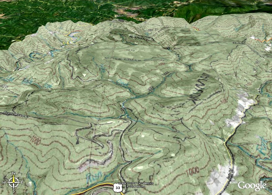
 I found a cool way to create 3D overlays maps for Google Earth. Just download a copy of google earth if you don't have it already (its free!), and then go to http://www.gpsvisualizer.com/index.html and click on Google Earth Overlays. From there, you can enter the lat/lon or zipcode for the area you are interested in, set the size of the area, and select from a variety of overlays, including USGS topos and aerial. It will then generate the overlay, at which time you can download it. When you select the download option, Google Earth will automatically load (if it is not already), and take you to the overlay area. You can then adjust the opacity of the overlay to your desired level. You can also have more than one overlay for an area displayed at a given time. The overlay shown here is a combination USGS topo and aerial of the Otter Creek Wilderness area in WV. Enjoy.
No comments:
Post a Comment