Sunday, September 14, 2008
Canaan Mountain Backpack, WV
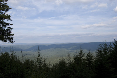
We hiked into the Canaan Mountain area on September 5-7, for a 3 day / 2 night backpacking trip, on a route outlined by Mr. Hyker at midatlantichikes.com. We started at the Blackwater State Park lodge parking lot, and stayed the first night in a hiking shelter located on the Railroad Grade trail. The view from Table Rock Overlook was very nice, well worth the extra couple of miles it added to the trip. We decided, due to the weather, to hike back to the shelter located at the conjunction of Plantation and Davis trails for the second night. The last day was a short 3 mile hike back to the lodge via Davis and Yellow Birch trail. Overall, the was an easy hike. Plantation trail is flat and straight as an arrow. The only portion that I did not enjoy was the time spent on CLR13, a gravel forest road, full of bear hunters, their pickup trucks, and their dogs. We did not see any other hikers on the trail the entire trip. After returning to the lodge, we drove out to Lindy Point and made the short hike out to the overlook, which offers a fantastic view of the Blackwater Canyon.
High Falls of the Cheat River, WV
We hiked to the High Falls of the Cheat River on Saturday, August 23rd. We began our hike at the High Falls Trailhead, located 4 miles south of the small community of Glady, on Forest Road 44. After crossing the foot bridge over the West Fork of the Glady, we began ascending Shavers Mountain, passing through a large open field with the West Fork Rail Trail running through it. High Falls trail soon enters the woods as it quickly begins climbing Shavers Mt. via a series of switchbacks. The climb is not bad, and the trail is in good shape and well marked. Toward the top of the mountain the trail passes through a lush forest of ferns before finally meeting up with Allegheny Trail in a saddle at the top. We stayed on the High Falls trail and began the descent down into the Shavers Fork of the Cheat river valley. This portion of the trail was rocky in places, and toward the top we were able to pick our share of blackberries. At the bottom, we finally came to the Cheat river, turning north on the railroad tracks and followed them down stream for 1/2 mile to the High Falls. There's a train depot located here so that those who are unwilling to make the trek over the mountain can also experience the beauty of the falls via the Cheat Mountain Salamander passenger train. The falls are nice, but there wasn't much water flowing over them during our visit. It was also very busy, with quite a few campers and some fishermen in the area. We returned to our vehicle using the same route. Overall, it was approximately 5 miles round trip. A nice day hike. The bottom photo is taken from the Gaudineer Scenic Area off of route 250, a few miles west of Durbin.
Subscribe to:
Posts (Atom)


