Wednesday, May 10, 2006

Spring Trout Fishing in WV

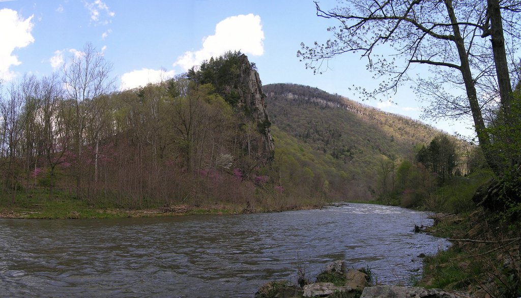
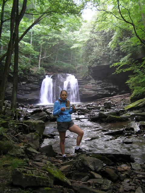
A big group of family and friends went on a 3 day trout fishing trip last weekend. We car camped next to Seneca Rocks at the Yokum Indian Campground, and fished the South Branch and the North Fork of the South Branch of the Potomac. This is a photo of the South Branch up-river of the Smoke Hole Canyon. Posted by Picasa

Tuesday, May 09, 2006

Google Earth 3D Topographical Overlays

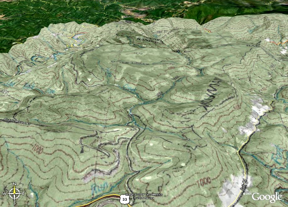
I found a cool way to create 3D overlays maps for Google Earth. Just download a copy of google earth if you don't have it already (its free!), and then go to http://www.gpsvisualizer.com/index.html and click on Google Earth Overlays. From there, you can enter the lat/lon or zipcode for the area you are interested in, set the size of the area, and select from a variety of overlays, including USGS topos and aerial. It will then generate the overlay, at which time you can download it. When you select the download option, Google Earth will automatically load (if it is not already), and take you to the overlay area. You can then adjust the opacity of the overlay to your desired level. You can also have more than one overlay for an area displayed at a given time. The overlay shown here is a combination USGS topo and aerial of the Otter Creek Wilderness area in WV. Enjoy. Posted by Picasa

Wednesday, April 26, 2006

National Forest Land for Sale !!!

The Bush Administration plans on selling parts of our National Forest lands to cover budget short falls. This proposal is being disguised under the "Secure Rural Schools" proposal. For more info, go to: http://westvirginia.sierraclub.org/announcements/p006.html. Anyone who has ever used or plans to use these National Lands should get involved to stop this before it's too late. They are selling off our inheritance. A little here, a little there, and before you know it, it will all be gone!

Saturday, November 05, 2005

Apollo enjoying a warm fall day.

This photo is not hiking related, but it's such a beautiful photo that I couldn't resist sharing it. It was taken last weekend at my parents house in the country. Posted by Picasa

Panorama shot of Tea Creek Backcountry

 Posted by Picasa

Apollo on Tea Creek

 Posted by Picasa

Tea Creek Backcountry

Posted by Picasa

Tea Creek Backcountry

 Posted by Picasa

Tea Creek Backcountry

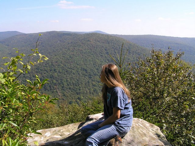
It's been awhile since my last post. We have been really busy this fall, but we did take a long weekend in late September and went car camping in the Cranberry Wilderness Area. We camped at the Tea Creek campground, and hiked in the Tea Creek backcountry. I have decided to wait until late winter/earyly spring before I start buying more backpacking equipment. I will post some photos of our trip.

Friday, August 26, 2005

hectic schedule

I just wanted to put an update in on what my wife & I have been doing for the past week. My life has been very hectic lately. We didn't get to hike any last weekend because I had to work. School started back this week, and I will be very, very busy for the next 4 months between working 2 jobs and my class load. We are not planning any overnight hikes this weekend, but we are going to try to get out and do a day hike at a nearby state park.

Friday, August 19, 2005

Backpacking Equipment

Since we enjoyed ourselves so much last weekend, we are now researching light-weight backpacking equipment. The first item I plan on buying is a tent. I have been looking at several brands and models so far. They are: Eureka Zeus 2EXO , Eureka Apex 2XTA, Kelty Gunnison 2, REI Half Dome 2 & MSR Hubba Hubba . My search criteria has been based on the following factors:
  • 3-season (no winter camping here :)
  • 2-person (leaning toward one with a little more square footage)
  • 2-door / 2-vestibule (lots of room for gear storage, and possibly the dog)
  • Light-weight (not a huge factor, as we can split the load between us)
  • cost (low to mid $100's if possible. Lets face it, I doubt if I tackle Everest anytime soon in this tent :) We just need something that is durable enough for hiking in the mid-atlantic States).
  • breathability (I hate waking up all sticky from condensation buildup).
  • factory-sealed seams

Anyone with experience in this, your comments are welcome. My thanks goes out to mrhyker at http://www.MidAtlanticHikes.com. He has been very helpful and friendly in his advise.

Tuesday, August 16, 2005

Seneca Creek Backcountry

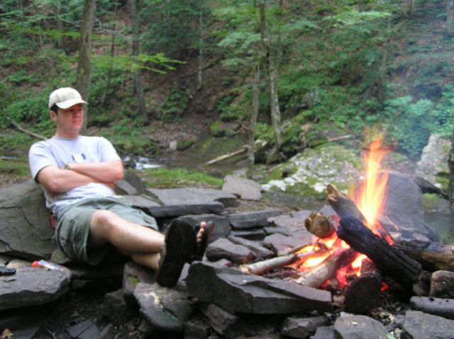
Last Saturday my wife and I took an overnight backpacking trip into the Seneca Creek Backcountry in WV. We started our hike at Spruce Knob, 4863 feet above sea level, the highest point in WV. Hiking down the Huckleberry Trail, the first couple of miles we stayed on top of the ridge, with a slight downhill grade. The trail was rather rocky in most places, making it difficult to traverse. The trail alternated between running through small spruce groves and high Alpine like meadows. Close to it's junction with Lumberjack Trail, Huckleberry Trail began to descend more rapidly. We stayed on Huckleberry to it's end, where it meets with High Meadows Trail for a short period before finally reaching the bottom of the valley and linking up with the Seneca Creek Trail. We camped along side Seneca Creek for the evening, with a beautiful view of the falls just upstream from our campsite. We started a small fire that evening (thanks to my wife), and Apollo enjoyed a refreshing swim in the stream. The next morning, we boiled some water out of the stream and refilled our water bottles. We decided to follow the creek up stream for a ways, keeping on Seneca Creek Trail. We had to cross the stream 3 times before finally arriving at Judy Spring. Seneca Creek is definately the most beautiful stream that I have witnessed in the state. Small waterfalls abound, and the surrounding valley is amazing. We hiked out of the valley via Judy Spring Trail, connecting back with Huckleberry Trail, and then back up, up , up to the Knob. Total mileage round trip ~12 miles. Elevation change ~1500 feet. We had a great time, although I believe we carried way to much weight. We need to buy new, lighter gear before our next outing. Pics are coming soon!

EDIT: I thought that I should point out that details for this hike can be obtained at http://www.midatlantichikes.com/id146.html . We elected to deviate from the route the author on this site had mapped out due to several reasons. We skipped the Lumberjack Trail / High Meadows Trail semi-loop due to time constraints, but we plan on returning and hiking this portion someday soon. Also, instead of taking Seneca Creek Trail out of the valley, we only hiked the portion up to Judy Spring Trail, taking it back to Huckleberry Trail and back tracking from there to the knob. If we had stayed on Seneca Creek Trail to it's head, we would've had to walk ~6 miles up forest road 112 to get back to our vehicle.